
Indo-Pacific Maritime Domain Awareness: Is the Quad Moving Fast Enough?
The Indo-Pacific maritime surveillance picture is becoming clearer.
In May 2026, Australia, India, Japan and the United States launched the Indo-Pacific Maritime Surveillance Collaboration, or IPMSC. The new Quad initiative will coordinate national surveillance efforts, facilitate real-time information sharing and initially concentrate on the Indian Ocean.
The announcement builds upon the Indo-Pacific Partnership for Maritime Domain Awareness, known as IPMDA. Launched in 2022, IPMDA supplies regional governments with commercially sourced maritime data, technology and training. It is also supporting the development of a common operating picture spanning the Indian Ocean, Southeast Asia and the Pacific.
Together, the two initiatives provide the institutional foundations of an emerging regional surveillance architecture. Software platforms can combine information collected by different sensors. Long-endurance uncrewed aircraft can maintain coverage across vast maritime areas. Regional fusion centres can analyse the resulting information and distribute it to authorised users.
Even so, significant gaps remain. Surveillance aircraft take years to acquire and integrate into national forces. Information-sharing arrangements are normally slow to develop and require high levels of trust. Many regional governments lack the personnel, communications systems and secure infrastructure needed to use a continuous flow of maritime data.
At the same time, China’s naval expansion and increasingly assertive coastguard operations give the Quad limited time to close those gaps.
What is maritime domain awareness?
Maritime domain awareness, or MDA, is the effective understanding of activities that could affect security, safety, economic interests or the marine environment.
The concept encompasses commercial shipping, fishing fleets, coastguard vessels, maritime militia, smuggling networks and environmental emergencies. Maritime authorities also need to identify ships that disable or manipulate their Automatic Identification System transmissions.
The scale of the Indo-Pacific makes this task especially difficult. The region extends from the western Indian Ocean to the Pacific coast of the Americas. It contains major energy routes, contested territorial waters and some of the world’s busiest maritime chokepoints.
No individual sensor can monitor this area continuously. Satellites provide broad coverage, with access determined by their orbits and tasking. Coastal radars offer persistent detection within a limited geographical range. Crewed patrol aircraft carry powerful sensors, with operating costs and crew requirements shaping the frequency of their missions. Uncrewed aircraft offer longer endurance and depend on communications links, ground infrastructure and trained operators.
Effective MDA therefore requires a layered system. Information from satellites, aircraft, ships, coastal radars and commercial databases must be correlated into a usable picture.
How IPMDA is building a common operating picture
IPMDA is the Quad’s principal regional capacity-building program for maritime awareness.
The initiative uses commercial satellite radio-frequency data to locate vessels through their electronic emissions. This can expose ships operating without valid AIS transmissions. The resulting detections can be combined with satellite imagery, coastal radar and vessel-registration records.
According to the Australian government’s description of IPMDA, the program provides near-real-time information to partners in Southeast Asia, the Indian Ocean and the Pacific. Its missions include illegal fishing enforcement, humanitarian response and monitoring other illicit maritime activity.
This unclassified approach allows the Quad to distribute useful information across a large group of governments. Regional partners gain stronger surveillance capabilities within an information environment designed for broad release.
IPMDA also supports existing regional organisations. In May 2026, the Quad confirmed that India had operationalised the program’s Indian Ocean component through the Information Fusion Centre–Indian Ocean Region in Gurugram.
The centre hosts international liaison officers and collects information from numerous national and commercial sources. Its location makes India a central hub in the Quad’s plans for a wider Indo-Pacific common operating picture.
What is the Indo-Pacific Maritime Surveillance Collaboration?
IPMSC adds an operational dimension to the Quad’s maritime programs.
The May 2026 Quad statement says the initiative will leverage the four countries’ maritime surveillance capabilities, improve information sharing and support subject-matter exchanges and tabletop exercises.
The official language assigns the two programs related roles. IPMDA provides maritime-awareness data and capacity to regional partners. IPMSC coordinates the Quad countries’ surveillance contributions.
IPMSC will augment IPMDA by sharing real-time information and producing a stronger picture of vessel activity. Exercise Malabar is expected to provide an early setting for surveillance coordination, according to comments following the Quad meeting.
The initial Indian Ocean focus reflects the region’s strategic importance. Energy supplies, commercial shipping and military movements pass through vulnerable routes extending from the Strait of Hormuz to the Strait of Malacca. India also possesses the geography, surveillance forces and information-fusion infrastructure needed to coordinate activity across this area.
Many operational details remain undisclosed. The Quad has not explained which surveillance platforms will participate, what categories of information will be shared or how quickly information will reach each country. It has also not identified the classification level of the new surveillance picture.
Those decisions will determine the initiative’s operational value.
How SeaVision supports maritime domain awareness
SeaVision provides an example of the technology required to turn dispersed detections into a shared maritime picture.
Developed by the US Department of Transportation’s Volpe Center and managed for maritime-security missions by the US government, SeaVision is a web-based platform used by more than 5,000 active users from 120 partner countries.
The system can display and correlate AIS vessel transmissions, satellite synthetic-aperture radar detections, satellite electro-optical imagery, satellite radio-frequency data, coastal-radar contacts, ship-registry information and alerts concerning unusual vessel behaviour.
An operator can use these sources to investigate a vessel whose identity, reported position or movements appear suspicious. A satellite RF detection can indicate the presence of a ship that has disabled AIS. Radar or imagery can then help classify and track it.
The US Navy identifies SeaVision as a core component of its IPMDA assistance to India. The $125 million initiative also incorporates commercial RF-detection capabilities supplied by HawkEye 360.
Access within SeaVision is divided into communities and narrower user groups called personas. Managers can restrict particular sources according to mission, nationality and data-licensing requirements. This tiered structure allows governments to collaborate within agreed boundaries.
SeaVision could also display processed information derived from military surveillance. A patrol aircraft might identify a vessel operating without AIS and contribute its location, classification or image to an authorised community. Publicly available information does not establish that raw aircraft sensor feeds routinely enter SeaVision.
The platform’s immediate value lies in distributing releasable information and giving partners a common analytical environment.
The growing role of MQ-9B maritime surveillance
Long-endurance aircraft provide the persistent collection needed to populate such systems.
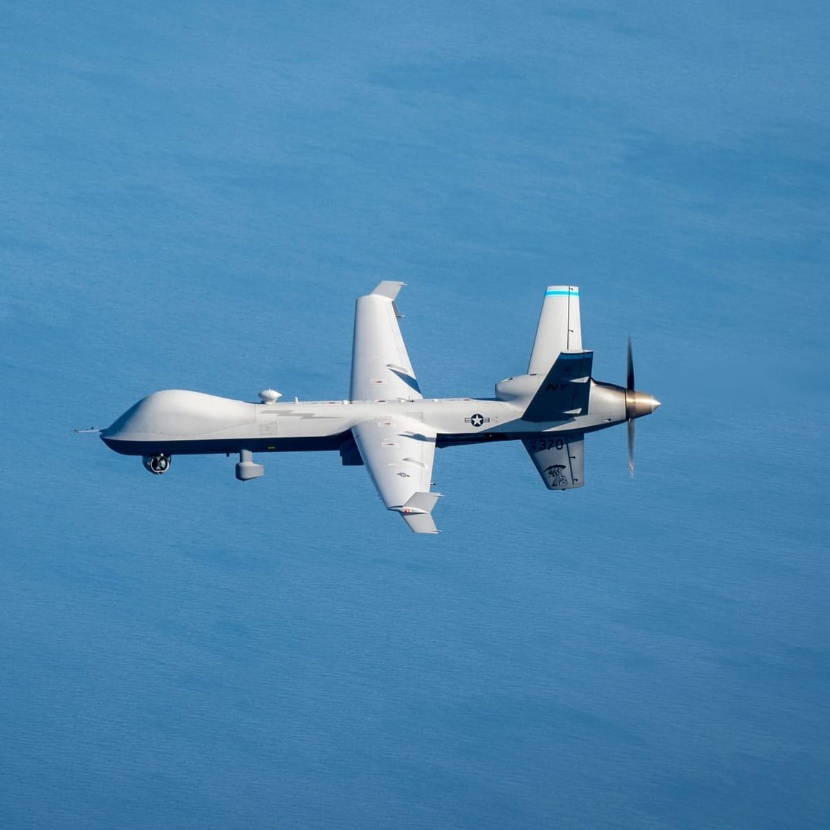
The MQ-9B family is gaining particular prominence. Its endurance and modular payload capacity allow it to monitor large areas, revisit suspicious activity and transmit information to operators beyond line of sight.
India is acquiring 31 MQ-9B aircraft under a package valued at approximately US$4 billion. The proposed equipment includes surveillance radars, electro-optical sensors, electronic-support systems, satellite communications and multiple tactical data links.
India’s investment creates the potential to combine persistent aircraft collection with the country’s growing information-fusion infrastructure. MQ-9B detections could support Indian maritime operations and contribute selected information to collaborative mechanisms.
Japan selected the MQ-9B SeaGuardian for the Japan Maritime Self-Defense Force’s long-endurance uncrewed aircraft program in November 2024. Its fiscal 2026 budget allocates ¥77 billion for four aircraft, ground-control infrastructure and associated services.
The Japanese Ministry of Defense says SeaGuardian will strengthen wide-area maritime surveillance and allow missions to continue with reduced risk to personnel. Japanese officials have also connected the program with stronger US–Japan information collection and analysis.
The platform could soon acquire another surveillance role. Saab and General Atomics completed the first flight of an MQ-9B carrying Saab’s LoyalEye airborne early-warning sensor on 19 May 2026. A fuller capability demonstration is planned after a multi-month evaluation.
The LoyalEye configuration is intended to provide persistent detection and tracking of aircraft, missiles and drones. It could eventually extend the MQ-9B family’s contribution from surface monitoring into airborne warning.
No public announcement currently links Indian or Japanese MQ-9B operations directly to IPMSC. Their adoption still illustrates the growing collection capacity available to Quad members.
Trust remains part of the infrastructure
Technical compatibility creates opportunities for information sharing. Governments determine which opportunities become routine practice.
Maritime data can reveal sensor performance, collection priorities and gaps in national coverage. Raw radar information or full-motion video may carry greater sensitivity than a processed vessel position. Governments can also interpret the same activity differently according to their interests and relationships.
A sustainable regional architecture therefore requires agreed rules covering ownership, access, classification, retention, onward distribution, cybersecurity and evidentiary standards. It also requires clear procedures for responding to shared alerts.
The Quad’s tiered approach reflects these requirements. IPMDA distributes unclassified information across a broad group of partners. IPMSC creates a framework for closer coordination among four governments with established security relationships.
This structure can expand as technical capacity and institutional trust grow.
China and the race for maritime transparency
China has reacted critically to the Quad’s growing security role. Following the May 2026 meeting, the Chinese Foreign Ministry said cooperation should support regional peace and avoid targeting third parties. Beijing also reiterated its opposition to exclusive groupings and bloc confrontation.
Greater maritime transparency creates strategic consequences for China. Persistent observation can document coastguard manoeuvres, identify patterns of maritime-militia activity and expose ships operating without valid AIS transmissions. Rapid information distribution also allows governments to release evidence while an incident continues to attract international attention.
This affects the utility of grey-zone operations, which often exploit uncertainty over identity, coordination and intent.
China retains substantial advantages in fleet size, proximity and operational tempo. Its navy, coastguard and maritime militia can generate activity across several disputed areas simultaneously. Regional surveillance systems must collect, analyse and distribute information quickly enough to support decisions during such events.
Detection produces its greatest strategic value when governments possess the legal authority, operational assets and political willingness to respond.
Is the Quad moving fast enough?
Indo-Pacific maritime domain awareness is progressing at three levels.
At the institutional level, IPMDA and IPMSC are creating structures for capacity-building, surveillance coordination and real-time information sharing.
At the technology level, SeaVision, commercial RF detection and regional fusion centres are improving the ability to identify suspicious vessels and distribute information.
At the hardware level, investment in aircraft such as the MQ-9B is increasing the persistence and geographical reach of national surveillance.
The remaining challenge is speed.
Aircraft acquisition programs unfold over many years. Software integration requires common standards and secure communications. Intelligence-sharing relationships develop through repeated operations and exercises. China’s maritime forces are already applying pressure in the South China Sea, around Taiwan and across the wider Indo-Pacific.
The region has limited time for its initiatives to mature.
IPMSC represents a meaningful step towards a connected surveillance architecture. Its success will depend on the information Quad members contribute, the speed at which that information moves and the number of operational decisions it improves.
The Indo-Pacific maritime picture is becoming clearer. The strategic contest will help determine whether it becomes clear soon enough.
Comments ()